Instant FIX on Site! Achieve Point Cloud, Photos, and Coordinate Guidance with a Portable RTK Surveying Device
This article takes an average of 2 minutes and 30 seconds to read
Published March 14, 2025
In construction site and infrastructure inspections, rapid and highly accurate positioning measurements are always required. However, traditional surveying methods have the challenge of being time-consuming and requiring manual labor.
For example, in total station surveying, it is necessary to work in pairs at each survey point (one person holding the prism and another operating the survey instrument), which tends to reduce efficiency.
In addition, typical GPS positioning can result in errors of several meters, making it unsuitable for precise surveying. To address these challenges, RTK technology has seen significant advancements in recent years, and the digitization and automation of positioning have progressed.
RTK-GNSS surveying uses two GNSS receivers, one at a reference station and the other at a moving station, to correct errors in satellite signals and achieve centimeter-level positioning accuracy. By capturing a sufficient number of satellites and resolving radio wave interference to obtain a fixed solution (FIX solution), RTK positioning accuracy is typically around 5-20mm.
With this high-precision real-time RTK technology, surveying tasks that previously took time can now be performed immediately on-site.
Now, a portable RTK surveying device is available to dramatically streamline on-site surveying. With just a palm-sized device, it is now possible not only to perform real-time high-precision positioning (instant FIX) but also 3D point cloud scanning, photogrammetry, and coordinate guidance. When every worker on-site carries this device, the era has arrived where surveying tasks that previously required multiple instruments and personnel can be completed with just one device. Below, we will explain in detail the technology and applications of this portable RTK surveying device, along with its benefits.
What is a Portable RTK Surveying Device?
A portable RTK surveying device is a surveying tool that incorporates RTK-GNSS technology into a compact device, allowing easy centimeter-level positioning directly on-site. The RTK system works by using two receivers: one placed at a known reference point (base station) and the other moving and positioning while receiving satellite signals. The base station data is used to correct the position of the moving station.
Through the correction calculations, the integer part (bias) of the satellite signal wave is resolved into an integer, and the resulting solution is called a FIX solution, which refers to high-precision position coordinates. RTK surveying devices can achieve this FIX solution in a few seconds to several tens of seconds once enough satellites are captured, enabling real-time positioning with errors within a few centimeters.
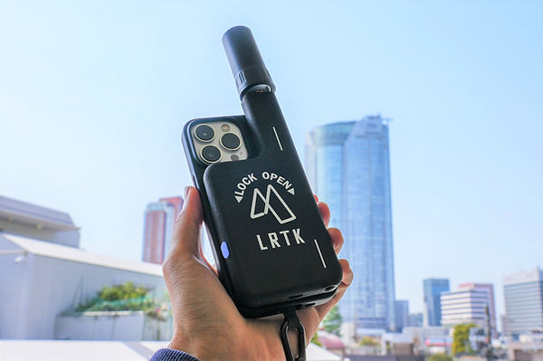
The "LRTK" is a pocket-sized RTK surveying device that attaches to a smartphone. With a compact and lightweight body of 125g in weight and 13mm in thickness, it can easily be carried to any job site.
As such, the key strength of the portable RTK surveying device is its ability to be easily carried by one person and provide immediate high-precision positioning. For example, in total station (TS) surveying, line-of-sight is required, and equipment setup and direction adjustment are needed for each survey. However, with the RTK surveying device, positioning can be initiated anywhere as long as the sky is open. Moreover, it can simultaneously measure multiple moving stations with a single base station, enabling 1-to-many observations. This allows for efficient operation, such as surveying multiple locations on-site by one person in quick succession.
Thus, the portable RTK surveying device, born from the evolution and miniaturization of RTK technology, is a solution that significantly overcomes the constraints of traditional methods regarding "manpower," "time," and "equipment." In the next chapter, we will explore the functionalities and benefits of instant FIX, point cloud scanning, photogrammetry, and coordinate guidance achievable with this device.
Benefits of Instant FIX, Point Cloud Scanning, Photogrammetry, and Coordinate Guidance
The portable RTK surveying device is equipped with a variety of functions in a single unit, dramatically improving both the productivity and accuracy of on-site work. Here, we will explain the benefits of the four key features: Instant FIX, Point Cloud Scanning, Photogrammetry, and Coordinate Guidance.
Improved Surveying Speed with Instant FIX
One of the major advantages of RTK surveying devices is the ability to obtain a FIX solution immediately on-site. In traditional GPS surveying, obtaining high-precision results required long observation times and post-processing analysis. However, with the RTK method, real-time correction calculations are performed, and under the right conditions, centimeter-level positioning can be achieved in just a few seconds. With a portable RTK surveying device, you can start positioning immediately after powering on, and once "Instant FIX" is established at the point you want to measure, high-precision coordinates can be obtained on-site.
With the ability to obtain surveying results instantly on-site, the speed of operations is dramatically improved. For example, in the past, the process involved "setting up reference points → surveying → data processing in the office → drafting," which took time. However, with a surveying device capable of instant FIX, you can complete the surveying and share results to the cloud on-site immediately.
This reduces delays caused by waiting for survey results, allowing decisions to proceed to the next step of the project on the same day, which contributes to overall project schedule reductions. The ability to achieve "Instant FIX" on-site is a significant asset in promoting field DX (Digital Transformation).
Improved Construction Management Accuracy with High-Precision Point Cloud Scanning
The portable RTK surveying device is not only capable of position measurement but also excels in 3D point cloud scanning. Modern smartphones are equipped with LiDAR sensors, and by combining this device with RTK, you can collect high-precision 3D point cloud data while walking on-site.
In traditional smartphone-only LiDAR scanning, the coordinates were often local, and there was an issue with point cloud distortion during walking scans. However, by continuously tracking the position with centimeter-level accuracy using RTK, global coordinates can be assigned to all points, and distortions can be corrected. Now, anyone can obtain highly accurate point cloud data without the need for specialized knowledge or expensive laser scanners.
Using the LRTK Mounted on an iPhone for 3D Point Cloud Scanning and Distance Measurement
This shows how 3D point cloud scanning and distance measurement are performed using the LRTK mounted on an iPhone. The distance between any two points (red line) on the obtained point cloud can be directly measured on-site.
By utilizing point cloud data, the accuracy of construction management is greatly improved. Tasks such as calculating soil volume or comparing the design model with the as-built condition can be done immediately on-site using the 3D point cloud data.
For example, if the volume of fill or excavation can be calculated on-site, any excess or deficiency can be identified immediately, allowing for adjustments to heavy machinery operations. Additionally, the acquired point cloud data can be shared via the cloud, allowing stakeholders to view and measure the data on office PCs without requiring specialized software. This means that all relevant parties can instantly access the high-precision 3D data measured on-site, preventing discrepancies and rework, thus enabling smooth construction management.
Easier Visual Management with the Use of Photogrammetry
The portable RTK surveying device excels in the field of photogrammetry as well. By automatically attaching high-precision position and orientation data from RTK to on-site photos taken with the smartphone camera, you can immediately know where and in which direction the photos were taken.
Previously, the location of photos was managed using visual markers in the photos or handwritten notes. However, thanks to the RTK device, photos are automatically plotted on a map and saved to the cloud as soon as they are taken, preventing record errors and significantly reducing time.
The photo data is automatically organized in chronological order, making it very convenient when creating reports in the office later.
The benefit of photogrammetry is that it provides visual information that makes it easy to intuitively grasp on-site conditions. For example, fine details of the site that may be unclear from point cloud data or drawings are immediately apparent when viewed in photos with high-precision location information. In construction progress records and infrastructure maintenance, it is often necessary to take photos continuously from fixed points, but capturing images from the same location and angle each time was a challenging task. Photos taken with the portable RTK surveying device are accurately aligned on a public coordinate system, allowing photos from different times to be perfectly overlaid and compared.
This greatly enhances the ability to track changes over time and verify as-built conditions. The ability to accumulate and utilize on-site events in the form of photos will make it easier to share surveying data as "viewable documents" with stakeholders, facilitating smoother on-site management.
Positioning Work on Site Using the Coordinate Guidance Feature
The portable RTK surveying device is equipped with a coordinate guidance (positioning guidance) feature that navigates users to a specified coordinate. By using this feature, you can simply input the target coordinates in advance, and by following the arrows and guides displayed on the device’s screen, you can reach the point with centimeter-level accuracy on-site. Even when there are no markers or stakes at the measurement point, the device helps you arrive at the location without getting lost, significantly improving the efficiency of stake driving, positioning work, and boundary marker search at surveying sites.
The coordinate guidance feature is useful in various scenarios. For example, when confirming land boundaries, boundary markers may be hidden by vegetation, making them difficult to see. However, with the guidance feature, even if the marker is hidden, the device will guide you to the exact location, ensuring it is not missed. Additionally, in disaster surveys or infrastructure inspections, when it's necessary to revisit the same location as a previous survey, anyone can easily identify the same position on-site using the coordinates recorded last time. This means that even if there is a gap between surveys or a change in personnel, data can be collected consistently at the same observation points.
Furthermore, in construction sites, for tasks like "stake driving (positioning)," surveyors used to rely on design plan coordinates to set up benchmarks and markings on-site. With the coordinate guidance feature of the portable RTK surveying device, workers can move directly to the pre-set design coordinates with the device in hand and drive stakes at the exact location. The distance and direction to the target point are always displayed on the screen, making positioning intuitive, and a single person can complete the stake driving task on their own. In this way, the coordinate guidance feature revolutionizes on-site tasks involving "point identification," making them more efficient, reliable, and faster.
Introduction to LRTK Products
As a specific example of a portable RTK surveying device with the features mentioned above, we introduce the recently popular "LRTK Phone."
By simply attaching a 125g receiver to a smartphone, this all-in-one surveying device allows positioning, point cloud measurement, layout marking (positioning), photo capture, and AR simulation with centimeter-level precision and global coordinates. What's revolutionary is that the acquired data can be shared instantly on the cloud, and the price is set at a highly affordable rate compared to traditional surveying equipment.
It has gained attention as a true on-site device, with field technicians able to carry it around like a smartphone, ready to use whenever needed.
What sets LRTK apart from traditional products is its ease of use and versatility. While other high-precision GNSS surveying equipment tends to be expensive and requires specialized operation, LRTK is designed to be accessible to anyone with a commercially available smartphone.
The device is ready to use with just a one-touch attachment of the receiver to a dedicated smartphone case, significantly reducing setup time on-site. Furthermore, with the ability to handle everything from point cloud measurement to coordinate guidance, there is no longer a need for multiple devices such as a surveying instrument, camera, and 3D scanner.
For example, with just the LRTK, even workers without surveying expertise can easily perform point cloud scans with coordinates and complete distance, area, and volume calculations on-site. This greatly simplifies the surveying workflow on-site and eliminates bottlenecks in the process.
Additionally, LRTK is a solution that integrates with cloud services. Point cloud data and photos acquired on-site can be uploaded to the LRTK cloud for sharing and analysis, allowing 3D data from the site to be viewed remotely from the office, or pre-set coordinate data to be synchronized with the on-site device for coordinate guidance.
Seamless data integration between the field and office eliminates the time lag in reporting and instructions, making it easier to support the site remotely. It is truly a tool that supports real-time information sharing and decision-making, which is essential in the era of construction DX.
Dramatically Improve Surveying Accuracy and Work Efficiency on Site with LRTK
The LRTK series enables high-precision GNSS positioning in the construction, civil engineering, and surveying fields, allowing for significant reductions in work time and dramatic improvements in productivity. It also supports i-Construction, a project promoted by the Ministry of Land, Infrastructure, Transport and Tourism, making it the ideal solution for promoting digitalization in the construction industry.
For more details about LRTK, please visit the links below:
If you have any questions about our products, quotes, or inquiries regarding implementation, feel free to contact us via the inquiry form below. Let LRTK help take your site to the next stage of evolution.