Contributing to Improved Productivity in the Construction Industry!
Benefits and Applications of Smartphone RTK Technology
This article takes an average of 2 minutes and 30 seconds to read
Published March 14, 2025
The construction industry continues to face a severe labor shortage, and improving productivity has become an urgent issue. For example, the effective job opening ratio for construction, civil engineering, and surveying technicians is about 5.99, significantly higher than the overall average of 1.29, highlighting the labor shortage. Additionally, traditional surveying tasks require specialized skills and significant time, leading to concerns over rising labor and outsourcing costs. Large-scale surveying requires numerous personnel, long working hours, and external outsourcing costs, placing a heavy burden on both work efficiency and cost management.
One solution that has gained attention for addressing these challenges is the integration of smartphones and RTK technology. Smartphone RTK is a solution that combines high-precision RTK (Real Time Kinematic) positioning technology with smartphones, enabling anyone to easily perform centimeter-level positioning. With the advent of smartphone RTK technology, surveying tasks, which were previously expensive and handled by specialized technicians, can now be significantly streamlined, offering the potential to improve productivity in the construction industry. This article will discuss the benefits of smartphone RTK for the construction industry, its practical applications, and introduce the promising device "LRTK" along with examples of its use.
The Basics of RTK Technology and Traditional Challenges
RTK (Real Time Kinematic) is a technology that uses satellite positioning systems (GNSS) to measure high-precision positions in real-time. With standard GPS standalone positioning, there is an error of several meters, but in RTK, two receivers are used simultaneously: a reference station (a receiver installed at a known coordinate) and a mobile station (the receiver being positioned). They communicate their data to correct errors. Specifically, both the reference station and the mobile station receive signals from at least four satellites, and the error information obtained by the reference station is sent to the mobile station in real-time, allowing for much higher precision than standalone positioning. This enables positioning of both horizontal and vertical locations with accuracy within a few centimeters, making it extremely useful in surveying and construction sites.
However, traditionally, performing RTK positioning on-site required expensive equipment and skilled operators. The introduction of typical RTK-GNSS surveying equipment required an investment of several million yen, with professional-grade GNSS receivers often costing over 1.3 million yen. Additionally, the equipment itself was large and cumbersome to transport, and setting it up and operating it required specialized knowledge. For small construction companies and surveying offices, these high costs and technical challenges were a significant burden. Furthermore, traditionally, sharing surveying data also took time, and there were additional steps such as manually transferring the data to a PC via USB and then creating drawings.
Amid the challenges of traditional technologies (high costs, specialization, and inefficiencies in data utilization), smartphone RTK technology has emerged, combining the versatility of smartphones with the high precision of RTK. By utilizing the smartphone at hand, this technology significantly lowers the barriers to RTK positioning and is expected to become a new surveying method that anyone on a construction site can use.
Benefits of Smartphone RTK
Smartphone RTK technology offers the following major advantages compared to traditional surveying methods.
-
Cost Reduction:
Smartphone RTK allows for high-precision positioning simply by attaching an add-on device to an existing smartphone or tablet, eliminating the need to purchase expensive dedicated equipment. Traditionally, RTK-compatible surveying equipment could cost several million yen, but in recent years, smartphone-compatible RTK receivers have become available for under 100,000 yen. The significant reduction in initial investment costs makes it more accessible for small and medium-sized construction and surveying businesses to adopt. -
Improved Work Efficiency:
Smartphone RTK leverages the widely familiar smartphone platform, allowing for intuitive operation of positioning and surveying tasks. Instead of the complex control panels typical of specialized equipment, positioning results can be checked and point names (labels) entered directly on the smartphone app screen. Measurement data can also be shared instantly on the cloud, allowing real-time information sharing within the team. Compared to traditional equipment, the price is more reasonable, making it feasible for each worker to have their own device and perform the necessary measurements immediately. This leads to faster on-site decision-making without having to wait for the surveyor, significantly improving overall work efficiency. -
Data Sharing and Cloud Integration:
Leveraging the features of smartphones, positioning data and survey results can be uploaded directly to the cloud for storage and sharing. For example, photos and notes can be attached to the measured points from the dedicated app, and by recording them on the cloud, it becomes possible to instantly access the survey results from the office. This shortens the lead time from surveying to drafting, allowing the measured data to be immediately used for construction management and report creation. Smartphone RTK, as part of ICT construction, strongly supports centralized data management and information sharing among teams.
As mentioned above, smartphone RTK brings significant advantages in terms of cost, ease of use, and data utilization. On-site, a workflow so fast that "measure and use immediately" becomes the motto is realized, allowing high-precision surveying and as-built verification to be performed with a small team, even amid labor shortages.
Applications of Smartphone RTK
By using smartphone RTK technology, various smart surveying applications are created in the construction and infrastructure maintenance fields. Here, we will introduce some representative use cases.
3D Surveying with Point Cloud Scanning
By utilizing smartphone RTK, 3D surveying through photogrammetry or LiDAR scanning can be easily performed. Photos taken with an RTK-enabled smartphone are tagged with high-precision location information (geotags), so by combining multiple photos using dedicated apps or software, accurate 3D point cloud data of the site can be generated.
Traditional point cloud measurements, which required expensive 3D laser scanners or drones, can now be done by simply walking around the site with a smartphone, obtaining 3D models with centimeter-level accuracy. The acquired point cloud data can be directly uploaded to the cloud for analysis or used in CAD software to calculate the volume and dimensions of terrain and structures. For example, by capturing a riverbank slope with smartphone RTK and converting it into a point cloud, the volume of earth can be calculated and deformation areas can be detected instantly in the office, reducing the time required for surveying, design, and construction planning.
Furthermore, 3D point clouds are also effective for as-built management. By recording the shape of the fill or land development after construction in a point cloud, accurate 3D models and cross-sectional views can be created even after completion, without the need for drawings. This can be useful for quality control and future renovation planning. In this way, 3D surveying with smartphone RTK greatly contributes to improving the accuracy of site records and streamlining maintenance tasks.
Streamlining Stake-out Tasks
Smartphone RTK is revolutionizing stake-out (positioning) tasks on construction and civil engineering sites. Traditionally, stake-out work, which involves marking positions on the ground based on design dimensions using surveying equipment, required multiple people and careful, time-consuming effort. With smartphone RTK, coordinate data defined in design drawings or BIM/CIM can be imported into the smartphone, and positioning can be guided on-site using AR (Augmented Reality). For example, in the LRTK app, by specifying the coordinates of the target location, a virtual stake (AR stake) marking that point can be displayed on the smartphone screen. The worker simply follows the on-screen instructions to move and can reach the exact location, where they can perform marking or stake installation.
The ability to perform stake-out tasks solo is a significant advantage. By combining RTK-enabled smartphones with AR technology, stake-out work, which was traditionally done by "two-person teams," can now be completed by one person. Additionally, with the method of placing virtual stakes on the smartphone, positioning can be done safely even on dangerous slopes or in hard-to-reach areas. Even when stakes cannot be driven into hard concrete surfaces, they can be placed virtually in AR, allowing for accurate positioning without marking the ground. Streamlining stake-out tasks will lead to faster construction and reduced manpower in various situations, such as establishing building reference points or identifying the locations of infrastructure equipment.
As-Built Management and Data Sharing
Smartphone RTK is a powerful tool for both during and after construction for as-built management. For example, in road construction or railway facility maintenance, the shape of completed structures or the position of installations can be measured with smartphone RTK. By instantly saving this data to the cloud, necessary information for electronic delivery or maintenance records can be automatically accumulated. This significantly streamlines the as-built management tasks, which traditionally required staff to manually measure, photograph, and record the data.
Additionally, the as-built data obtained via smartphone RTK can be shared in real time among stakeholders, allowing immediate information sharing with the general contractor's headquarters or the client (e.g., infrastructure representatives from JR or highway companies). By sharing the data on roadbed compaction height or tunnel displacement measurements via the cloud, remote technicians can access the data, make decisions, and issue instructions. Compared to the era of relying on paper forms, data-driven as-built management becomes a reality.
Furthermore, accumulating the acquired data can be used for future maintenance planning. By recording the changes in infrastructure equipment over time as point cloud data, it becomes easy to compare differences during future inspections and detect areas of deterioration. Smartphone RTK makes it possible to not just measure, but to store and utilize data, creating a new as-built management cycle.
Introduction to LRTK
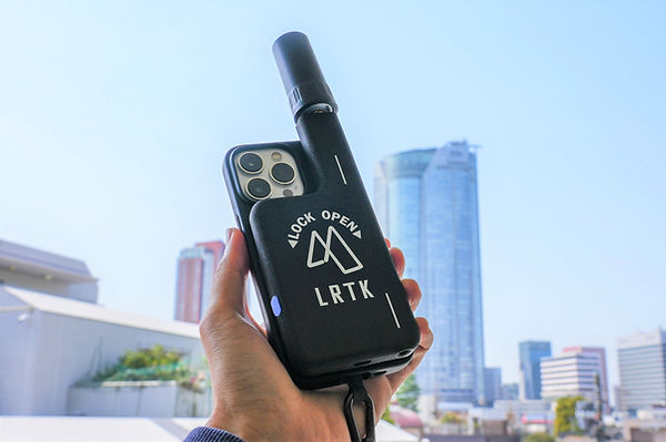
As a concrete product that realizes the benefits and applications of smartphone RTK mentioned above, there is a solution called LRTK (Lefixea RTK). LRTK is a pocket-sized, versatile surveying device called "LRTK Phone," developed by Lefixea, a startup from the Tokyo Institute of Technology. Below, we introduce its features and achievements.
The LRTK Phone is a device that attaches a compact RTK-GNSS receiver to an iPhone or iPad, transforming the smartphone into a centimeter-accurate surveying tool. Weighing approximately 125g and only 13mm thick, it has a built-in battery, making it a highly portable and practical device. With this single device, you can perform positioning (coordinate acquisition), point cloud scanning, stake-out, photo recording, and even simulations using AR, with the acquired data instantly shared on the cloud. The price is set to be extremely reasonable compared to traditional surveying equipment, making it an ideal "one device per person" tool for various sites. In fact, there have been reports of it becoming a quiet trend among field practitioners, indicating that its ease of use and practicality are highly valued on-site.
Benefits and Case Studies of LRTK
By introducing LRTK, you can fully enjoy the benefits of smartphone RTK mentioned earlier. For example, one construction company replaced as-built measurements, which previously took half a day using a total station, with LRTK, significantly shortening the measurement time and completing the cloud sharing on the same day. Additionally, in stake-driving work, the AR functionality of LRTK has allowed a single person to perform stake-out tasks, which were previously done by multiple people, with accuracy. Since LRTK can be intuitively used even by those who are not surveying specialists, there have been reports of it being deployed without training costs in small and medium-sized civil engineering companies and infrastructure maintenance departments. Furthermore, a model that supports CLAS (Centimeter-Level Augmentation Service) signals provided by the quasi-zenith satellite Michibiki has been made available for use in areas where mobile signals are unavailable, such as mountainous regions or near tunnels.
In infrastructure management, where many sites are out of mobile signal range, it has been praised as "reliable because it works even in areas without signal," and there have been reports of LRTK being useful during disasters when the mobile network was disrupted. In this way, LRTK is being adopted at various sites across Japan and is gaining attention as a key technology supporting ICT construction.
Significantly Improving Surveying Accuracy and Work Efficiency on Site with LRTK
The LRTK series enables high-precision GNSS positioning in the construction, civil engineering, and surveying fields, allowing for significant reductions in work time and substantial improvements in productivity. It is also compatible with i-Construction, promoted by the Ministry of Land, Infrastructure, Transport, and Tourism, making it the ideal solution for promoting digitalization in the construction industry.
For more details about LRTK, please visit the following links:
If you have any questions about our products, requests for estimates, or inquiries regarding implementation, please feel free to contact us using the inquiry form below. Let LRTK help take your construction site to the next stage.