Visualizing the Site with AR Surveying:
New Technology Made Possible by iPhone and RTK
This article takes an average of 2 minutes and 30 seconds to read
Published March 14, 2025
In the construction industry, surveying is an essential and crucial process, but traditional methods come with various challenges. With the worsening labor shortage, it has been pointed out that the surveying sector has not seen significant technological innovation for about 50 years, and if it fails to keep up with the wave of digitalization, the industry itself may decline. Surveying requires skilled techniques and teamwork, and the process is time-consuming on-site, which strongly calls for efficiency improvements and DX (digital transformation).
Traditional surveying methods use specialized equipment such as total stations and levels, with at least two people needed to measure each point on-site. This involves a lot of setup, calibration, and target placement, and there is a limit to the number of points that can be measured in a day. Additionally, the process of turning surveying results into drawings is necessary, which can lead to high time and cost requirements. Furthermore, the recent shortage of experienced surveying technicians has become particularly evident, and if this continues, maintaining the quality and speed of on-site surveying will become increasingly difficult.
A new "AR Surveying" method that combines AR (Augmented Reality) technology and RTK positioning is gaining attention as a game-changing solution to address these challenges. By leveraging smartphones (especially iPhones equipped with LiDAR scanners) and RTK-compatible GNSS receivers, it has become possible to conduct high-precision surveying while visualizing the site in real-time. This innovative approach using iPhone and RTK not only digitizes and streamlines the surveying process but also allows for an intuitive understanding of the site conditions. In this article, we will explain what AR surveying is, how it works, its benefits, its use cases in construction, and the advantages of implementing LRTK Phone, its representative solution. Finally, we will also introduce the next steps for implementing RTK surveying, including how to request materials for free.
What is AR Surveying?
AR surveying is a new method that applies Augmented Reality (AR) technology to surveying. By using the camera of a smartphone or tablet, digital information such as design drawings and surveying data can be overlaid onto the real-world image, allowing for an intuitive understanding of "where to place what" and "how the design deviates from the actual site." Information that was previously checked visually with drawings or marked stakes can now be displayed as 3D models or guidelines on-site using AR. In other words, it is possible to visualize (make visible) the site’s conditions in real-time by overlaying what was once imagined on paper or in one’s mind onto the actual scenery.
In recent years, smartphones like the iPhone, which are equipped with LiDAR scanners, have become more widespread. By combining these with RTK receivers, which enable high-precision GNSS positioning, AR surveying has entered a practical stage. RTK (Real-Time Kinematic) is a technology that provides centimeter-level positioning accuracy in real-time by using GNSS satellites. By utilizing both AR for spatial recognition and LiDAR scanning functions on the smartphone, and combining this with the accurate self-positioning data obtained from RTK, digital information can be placed accurately in the real-world space. For example, in regular smartphone AR, there was an issue where the virtual model would shift as the user moved. However, by applying RTK for position correction, stable and accurate display without drift is now possible. Additionally, in places with no landmarks, RTK allows for pinpoint accuracy in determining the position of 3D models, making it helpful in identifying installation locations that were previously difficult to pinpoint.
AR surveying offers the following benefits:
-
Real-Time: By simply holding up the smartphone, you can instantly check surveying results and design data, allowing for on-the-spot verification and decision-making during work. This reduces the need to review drawings later in the office.
-
Intuitive Visualization: Information, including height and spatial distance, is displayed in 3D, making it easy to understand what would be difficult to grasp from just drawings. Even those without extensive experience can easily understand the site conditions, and communication with clients and other stakeholders becomes smoother.
-
High Precision: With centimeter-level positioning from RTK, the misalignment of the AR display is minimized, ensuring that the accuracy of layout work is comparable to traditional marking methods. You can perform verification and measurement with precision comparable to specialized surveying equipment.
-
Labor Savings: Surveying can be completed with just a smartphone and a compact GNSS receiver, eliminating the need for bulky equipment and additional personnel. Since one person can conduct the surveying and inspections, this leads to reduced workload for surveyors and helps address labor shortages.
-
Digital Utilization of Data: Data obtained from AR surveying can be stored and shared as digital information directly in the cloud. This eliminates errors from manual transcription into paper drawings, and the accumulated surveying data can be integrated with construction management systems or BIM/CIM models, contributing to construction DX.
LRTK Phone and AR Surveying
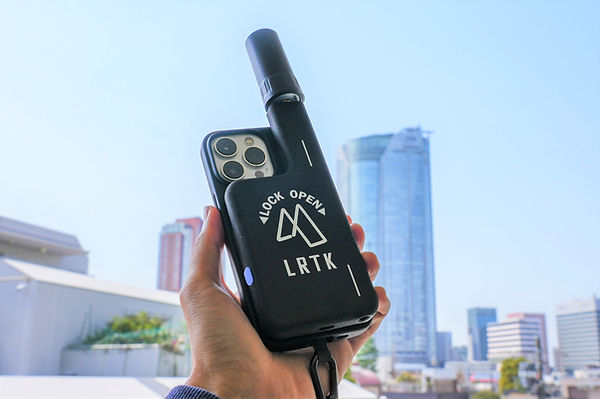
One of the specific solutions for implementing AR surveying on-site is the LRTK Phone, developed by Lefixia (a Tokyo Institute of Technology spin-off venture). This is a pocket-sized ultra-compact RTK-GNSS receiver that attaches to an iPhone or iPad. By simply attaching it to the smartphone, it enables positioning, point cloud measurement, layout, and AR display with centimeter-level precision in a global coordinate system, transforming the smartphone into a versatile surveying device.
Weighing only 125g and about 13mm thick, the device includes a built-in battery, offering the convenience of being easily portable and ready to use whenever needed. The price is also extremely reasonable compared to traditional surveying equipment, making it practical to equip each worker with one device to carry on-site.
With cloud integration functionality, the data acquired can be shared instantly in the cloud. This device is truly pioneering the era of smartphone surveying, where each worker can handle everything from surveying to data sharing with just one smartphone.
Now, let's take a look at what can be achieved with AR surveying using the LRTK Phone, focusing on its main features and use cases on-site.
-
Layout Work: With LRTK Phone, you can display virtual stakes or lines at the positions shown on the design drawings using AR. For example, even in areas where direct marking on the ground is not possible, you can display the location where stakes should be placed as virtual stakes on the smartphone screen. In locations where physical staking is difficult, such as steep slopes or concrete pavements, accurate positions can be indicated in AR, leading to labor-saving and improved accuracy for layout tasks that were previously challenging. Workers simply follow the on-screen instructions to mark the positions, significantly reducing the manual work that would typically involve measuring tapes and string lines.
-
As-Built Management: One of the strengths of AR surveying is the ability to check the as-built condition (the completed shape) on-site. By scanning the site with an LRTK-compatible smartphone, you can instantly obtain point cloud data of the as-built condition. By overlaying the design model on this data, you can check whether the embankment or structures are positioned and dimensioned as per the design. For example, you can easily calculate the volume of embankment material from the point cloud data obtained with the smartphone on-site. In the past, as-built management required a surveying team to visit the site after construction to verify the work, but with LRTK Phone, the construction manager can perform the verification in real-time, preventing rework and ensuring quality control.
-
Construction Simulation: AR surveying also proves useful during the planning stage before construction. By combining the on-site terrain data obtained with LRTK Phone and design 3D data such as BIM/CIM, you can perform construction simulations on-site. For example, before building a bridge, you can display the 3D model of the bridge in AR on-site to check its integration with the surrounding environment, or in tunnel construction, you can display the planned excavation lines on the tunnel wall to visualize the excavation area. Since design models uploaded to the cloud can be synchronized with on-site coordinates and displayed without the need for alignment, the models will appear at the correct locations instantly. This greatly simplifies the process of reviewing construction plans and reaching agreements with stakeholders.
Use Cases on Construction Sites
Now, let's take a look at how AR surveying technology can be applied in actual construction sites, focusing on the main scenarios.
-
Efficient Layout Work: In layout tasks, such as setting the reference lines for buildings or roads, AR-guided displays prove to be highly effective. When the surveyor points their smartphone, virtual lines or markers appear at the design’s specified locations. By simply following these instructions and marking the points, accurate layout work can be completed. This significantly reduces the need for traditional benchmark setup and measuring with tape, allowing a single person to handle tasks that were previously done by multiple workers. As a result, errors in marking points are reduced, contributing to shorter project timelines and improved quality.
-
Real-Time As-Built Management: If the as-built condition can be checked on-site immediately after the construction of embankments or structures, it helps prevent rework. With AR surveying, the surveyor can scan the construction area with a smartphone right after construction, overlay it with the design model, and check the as-built condition on the spot. For example, after grading the roadbed, you can compare it with the design height and visually highlight areas where it’s lower using color-coded displays on the screen. This allows for flexible actions, such as determining the required additional embankment volume and correcting it immediately, without having to wait for subsequent measurements.
-
Design Data Consistency Check: During the construction of complex structures, it is crucial to continuously check if the construction is being done according to the drawings. With AR surveying, the 3D design data can be overlaid onto the actual structure, making any discrepancies with the current condition immediately visible. For example, by displaying the design route for pipe installation in AR, the surveyor can instantly check if the actual pipes are deviating from the planned route. Similarly, during steel frame erection, displaying the virtual model of columns and beams at their installation positions helps prevent misplacement before it occurs. The ability to overlay design data with the site in real-time allows continuous checks for consistency between the design and construction, which is a significant advantage.
The technology of AR surveying is being increasingly applied on-site in various infrastructure projects such as road construction, bridge construction, and tunnel work. For example, in road construction, AR displays are used to show the lines of curves and the locations for sign installation, helping to prevent construction mistakes.
In bridge construction, the positions for bridge piers and beams can be checked in advance using AR displays, allowing workers to ensure there are no conflicts with the surrounding area. In tunnel construction, projecting design contours onto the excavation surface to verify direction and slope is also being explored.
In infrastructure maintenance and inspection, AR is expected to be used to display the location of underground utilities or to place virtual tags on inspection points. In the future, as part of construction DX, the scope of AR surveying applications will continue to expand.
Benefits of Introducing LRTK Phone
What changes can be expected in on-site productivity and construction management when implementing a solution like LRTK Phone? Finally, we will summarize the main benefits of introducing the LRTK Phone.
-
Streamlining Surveying Operations and Improving Accuracy: By equipping each worker with an LRTK Phone, surveying and layout tasks that previously required two people can now be completed swiftly by one person. Since position guidance and point cloud measurements can be performed on-site, setup times are greatly shortened, and overall productivity at the site improves. Furthermore, high-precision positioning using RTK ensures quality is maintained. Actual tests have demonstrated high accuracy with an average error of less than 1cm, achieving precision comparable to professional surveying equipment.
-
Cost Reduction for Equipment: When outfitting with specialized surveying instruments or 3D scanners, significant investment is required. However, with the LRTK Phone, you can utilize your existing smartphone, reducing initial investment costs. The device itself is inexpensive, with low running costs, and software updates for functional expansion can be done online. Compared to sharing expensive equipment, distributing devices to individual workers offers a high cost-effectiveness. As a result, this leads to cost reduction in surveying and simplifies equipment management.
-
Digital Transformation (DX) in Construction Management (Data Utilization): Surveying data and point cloud data obtained with the LRTK Phone can be immediately uploaded to the cloud for sharing. The information gathered on-site can be viewed directly on office PCs or shared with remote supervisors and partner companies, enabling real-time decision-making. The hassle of carrying paper drawings or transferring data via USB is eliminated, and everyone can access the most up-to-date site information. This digitalizes and streamlines the construction management process, and future integration with AI analysis or other DX tools becomes feasible. The accumulated data can also be used for trend analysis of construction progress and enhanced quality control.
-
Improving Safety and Quality: As an additional benefit, there are improvements in safety management. In situations where people used to climb dangerous slopes for surveying, AR surveying allows position determination from a safe, distant location. Early detection and correction of surveying errors reduce rework and minimize the risk of quality defects and accidents. The peace of mind provided by always following accurate guidance also contributes to reducing the mental burden on on-site staff.
As mentioned above, by introducing the LRTK Phone, fast, cost-effective, and accurate surveying and construction management are achieved, ultimately accelerating the DX of the entire site. For companies struggling with the aging of surveyors and labor shortages, this will surely become a powerful solution.
Significantly Improving Surveying Accuracy and Work Efficiency on Site with LRTK
The LRTK series achieves high-precision GNSS positioning in the fields of construction, civil engineering, and surveying, enabling significant reductions in work time and substantial improvements in productivity. It is also compatible with i-Construction, promoted by the Ministry of Land, Infrastructure, Transport, and Tourism, making it an ideal solution for advancing digitalization in the construction industry.
For more details about LRTK, please visit the links below:
-
What is LRTK|Official LRTK Website
-
LRTK Series|Device List Page
-
Case Studies|Applications on Construction Sites
For any questions regarding the product, quotations, or consultations about implementation, feel free to contact us through the inquiry form. Let LRTK take your construction site to the next stage.