top of page
Revolutionize the worksite with a 360° field of view and high-precision positioning
LRTK 360
CLAS-compatible

Fusion of high-precision positioning and 360° visual information
By combining centimeter-level positioning via GNSS-RTK technology with one of the industry’s largest 360° cameras, you can record and measure the site accurately and efficiently.


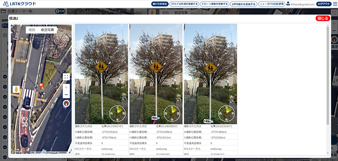
Visualize site changes with chronological display
When you upload the captured 360° photos to LRTK Cloud, the shooting positions are organized on a map and the site photos are displayed chronologically. Because data captured at the same location can be compared easily, it is ideal for progress management and fixed-point observation.
All you need is your smartphone
It has a built-in battery and comes with an antenna. Once you have correction data ready, you can start positioning immediately just by installing the dedicated app.

Details of LRTK 360

bottom of page